.jpg)

Solar Power Plant Operator
Solar power plant audit + digital twin
Solar power plant operations transformed with innovative data capture and digital twin construction
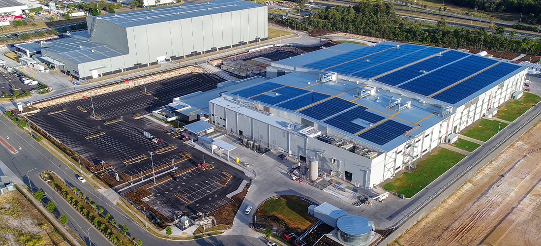
An international power production and water utility operator engaged Measure Australia for high-resolution digital terrain mapping and thermal imaging at a remote South East Asian solar power generation farm, to formally report on minute topographical conditions including beneath the solar panels. The formal report and presentation were utilised in certifying the plant, operational optimisations, the company’s legal action with two construction partners and a wider digital transformation journey. The solar power plant, which will not be named by agreement with the client, produces more than 60MW for the host country’s national grid.
OVERVIEW
Power plant construction was underway when MA was initially consulted in 2019, and nearing operation when MA was approached. The client’s experts had noticed erosion beneath numerous solar panel strings and raised concerns that it may deleteriously impact ambitious production targets. The erosion had occurred during the first annual ‘wet season’, which plant leadership recognised as a major concern and so requested senior leadership engagement. The client’s head of innovation and emerging technologies lead a panel that considered solutions through a lens that included bigger picture considerations of digital transformation. The organisation generally partners with leading technology specialists to prudently explore new opportunities and MA’s expert data capture, LiDAR technology, and economical digital twin capability via Asseti was considered favourably. The project went ahead with LiDAR, thermal image and photogrammetric data capture. This data was used in the construction of a digital twin of the solar plant. Immediate data uses included solar panel verification, certification of adherence to solar panel manufacturer requirements for warranty purposes, and legal action with the two construction contractors. The digital twin is established for ongoing operational and modelling use. Moreover, the client considered this solar power plant a pilot project for remote data capture and digital twinning across its asset portfolio.
SOLUTION
MA deployed two senior pilots to the country, with specialist equipment including the only Riegl MiniVux2 LiDAR sensor currently in the region. The Riegl MiniVux2 is extremely lightweight for drone mounting and uses waveform-LiDAR technology to deliver 1 million points per second, enabling the hyper-accurate mapping of the terrain underneath solar panels with a real resolution of more than 10,000 points per square metre. MA specialists managed to change environmental conditions that can impact LiDAR output – dust, humidity, heat and rain can all affect LiDAR accuracy – to ensure optimal resolution and accuracy was achieved. The formal report was prepared with the consideration that it may be foundationally important in case of damage claims. MA’s specialists also flew thermal imaging data capture flights. MA had deployed its high-end radiometric thermal imaging apparatus, which registers the temperature of every pixel in the image instead of an approximate temperature variance as most thermal cameras provide. Thermal imaging is commonly conducted at the completion of solar farm construction, as it enables evaluation of solar panel efficiency so that the operating organisation can approve or nominate solar panels as defective for replacement. Many solar power plants similarly conduct thermal imaging audits annually to identify maintenance priorities.
Numerous primary and secondary project objectives were to be reported, both to provide hard data for resolution of the site’s operational demands and to provide examples of data for the client’s wider portfolio. The head of innovation and emerging technologies explained that both the data capture and data utilisation project elements were watched closely by senior leadership and that ultimately the pilot project influenced the technology to be rapidly integrated to new projects. “We explained the technology, its context and the ramifications for use in future projects and you could feel the anticipation in the room,” they said. “Our CXO immediately recognised how revolutionary this could be – he was extremely pleased with MA’s report and Asseti, and immediately supported expanded drone data capture, digital twinning with the MA/Asseti model, and big data exploration.”
REPORT + RESULTS
MA’s report was detailed and robust. Water flow modelling was particularly crucial, and the digital terrain mapped by MA identified worn drainage flows and channels for contrast with those in construction plans. This terrain mapping was conducted using LiDAR point cloud. LiDAR is favoured for flood mapping as it delivers high-resolution accuracy without exposing surveyors to flood risks and as such is routinely used to model storm surge, emergency response, shoreline mapping, hydrodynamic modelling, coastal vulnerability analysis, and in hydrographic surveying. Crucially MA’s high specification LiDAR assembly was able to map terrain beneath the solar panels and through dense site foliage. All data was transmitted and processed into Asseti (MA is an Asseti partner and uses the platform exclusively for processing and provision). MA analysts reviewed captured LiDAR to gain an aggregate view of the ground terrain layer (including beneath panels) and then watershed modelling under the ‘nearest neighbour’ methodology was utilised for water flow modelling to quantify thresholds for site pits and troughs. Rigorous water flow modelling in a 0.25m2 grid, detailing hundreds of points in each grid location, was used for water flow comparison with change over time.
Numerous other elements, including subsidence modelling and powerline vectorisation, were detailed based on LiDAR digital terrain modelling and incorporated into the digital twin. The report included a fully researched expert thermographic condition and dilapidation report – delivered just over a week after the flights. Thermographic analysis is typical for solar power plant certification and validation of panel warranty. Conducting two thermal data captures, MA was able to robustly identify panels and strings that did not meet operational benchmarks and report these within Asseti. Asseti incorporates recommendation and prioritisation features to support maintenance and repair operations (MRO), which the client highlighted as a positive example of where data-driven and machine learning powered insights can be used to improve and expedite expert works. Asseti is also auditable with foundational architecture that is extremely secure and legally defensible.
“MA’s partnership is highly valued, across data capture and processing,” said the head of innovation and emerging technology. “We actively seek and evaluate best-in-class partners, and MA was ideal in technical capability, consultative expertise, and intuitive digital twin construction and reporting in Asseti.”
CEO Aonghus Stevens said the client has a record of innovation. “This client is a prudently forward-acting organisation in the utility and renewable space, so engaging with their innovation journey is powerfully important within the wider picture of both organisation’s ongoing success,” said Stevens. “The client is deeply imaginative and it is thrilling to see their digital twins come to life!”
“MA’s partnership is highly valued, across data capture and processing. We actively seek and evaluate best-in-class partners, and MA was ideal in technical capability, consultative expertise, and intuitive digital twin construction and reporting in Asseti.”
.png)