Architects, Contractors and many other professionals are increasing the quality of delivered projects through building information modelling (BIM). LiDAR laser scanning delivers high-quality information for BIM.
Building Information Modelling (BIM), coined in the 1970s has become a widely used application in the AEC (architecture, engineering, and construction) industry. Walking hand-in-hand with the digital era it has been the most useful application in the past decade to build dream projects virtually to perfection. While BIM has helped visualise buildings better, make accurate cost-estimations, and mitigate risk on construction sites, LiDAR laser scanning delivers exceptional quality data for many companies.
But first, what exactly is LiDAR for BIM?
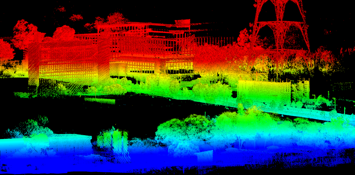
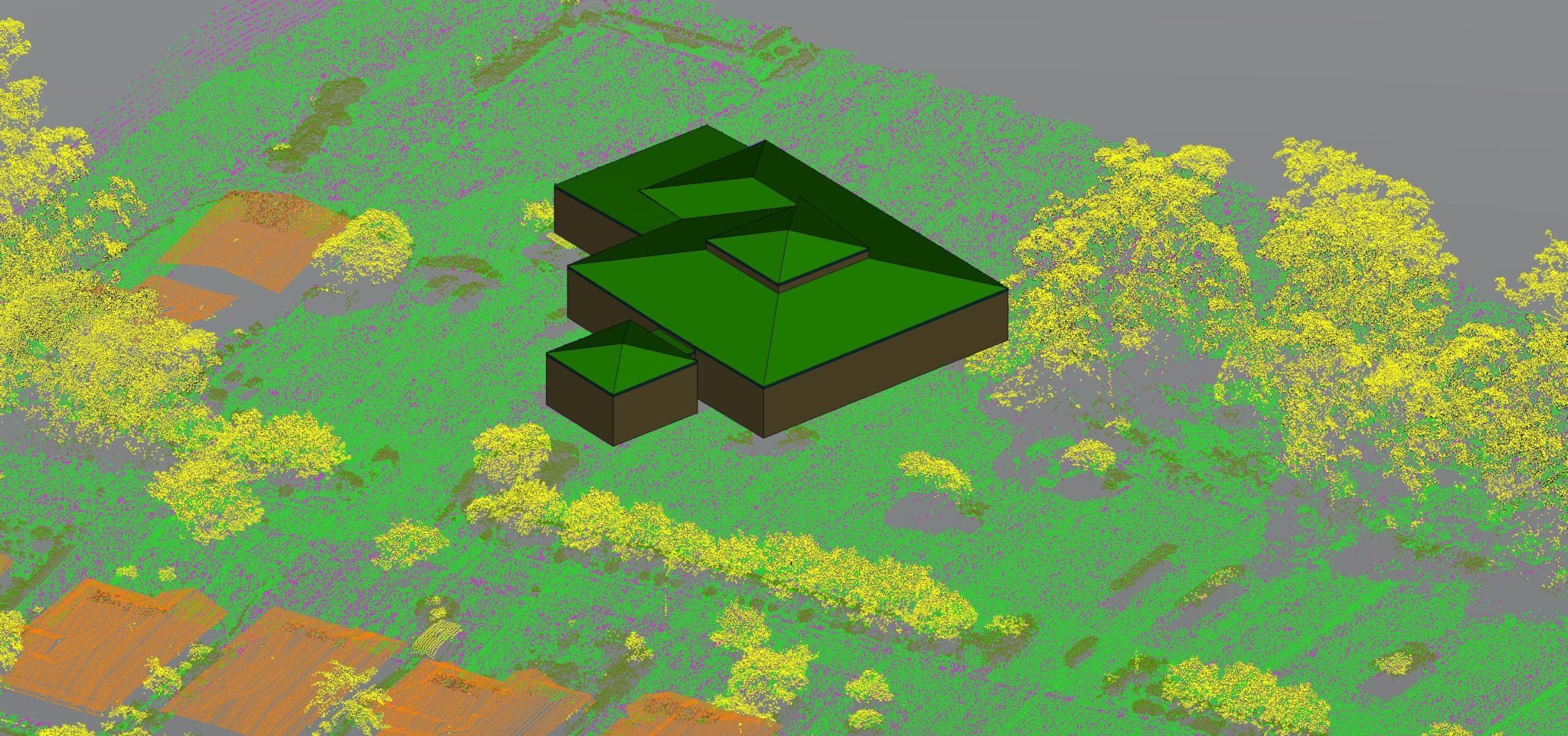
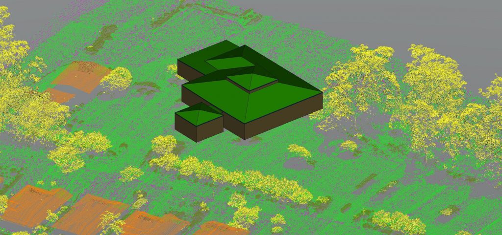
LiDAR is a remote sensing method that uses light in the form of a pulsed laser to measure ranges to a surface – ground, vegetation, buildings, etcetera. Light pulses from LiDAR, in combination with GPS or other location data, generate precise, 3D information about the shape of the terrain and the surface characteristics. Still, more importantly, it can do so as accurately for objects and buildings. LiDAR generates 3D models from millions of individual survey points; LiDAR data with these points is called a “point cloud”. Topographic and bathymetric are two types of LiDAR that exist. Topographic LiDAR laser scanning uses a near-infrared laser to map the land while bathymetric LiDAR laser scanning uses water penetrating green light to map the ocean floor.
How is LiDAR meeting BIM to disrupt various industries?
Precision, built-in point densities in LiDAR provide highly precise surface models strengthening the accuracy of analysis via 3D scan data. LiDAR sensors can generate accurate data for surface but also under structures such as bridges and utilities, providing information about the structure in entirety. Additionally, the LiDAR system can give a survey of any asset that is analysed. LiDAR surveying can help identify the condition of a pavement on a bridge or quantify the level of cracking of various structures.

How is it better than traditional methods?
Including surveying of the entire structure equates to an enormous amount of data which is a volume that cannot be collected by photogrammetric means and conventional topographic survey methods alone. LiDAR surveys are possible in day and night in low lightning conditions. LiDAR can penetrate in dense vegetation areas, which would be time-consuming, cost-intensive and potentially unsafe if done by traditional methods. Conventional photogrammetry method can only produce a reconstructed Digital Surface Model and experiencing stitching issues on many indoor areas, whereas LiDAR can deliver survey-grade Digital Surface/Terrain Models.
There are various methods of LiDAR scanning however, aerial LiDAR through drones is the most efficient way to gain the most benefits for BIM systems. Mobile LiDAR and Static LiDAR are the other options which service specific and niche aspects. Aerial LiDAR, which provides highly detailed and precise point clouds, was traditionally performed by helicopters and aeroplanes. Using manned aircraft resulted in soaring costs and delays of projects to achieve high accuracy aerial survey. The drone technology (unmanned aerial vehicles) provides the leading, cost-efficient solution, compared to other aerial LiDAR. Drone LiDAR laser scanning is safer (no injuries to surveyors involved), faster and more accurate than traditional methods. Learn more about LiDAR Surveying service via drones.
Capabilities of Measure Australia for BIM
At Measure Australia, we provide accurate and safe LiDAR drone solutions within the project timeline. Our laser scanning systems operate at upwards of 1,500,000 points per second and have a point density of 600-800 points per metre in 3D form and provide LiDAR laser scanning that has impeccable precision and accuracy. Additionally, working with BIM, we understand clients’ software restrictions, and therefore offer our clients with terrain data in several practical formats, including LAS/LAZ laser point clouds, 3D models, DXF/DWG vector files, ground contours and triangulated networks (TIN). The data can be imported and used in almost all the engineering and architectural software.
Measure Australia has provided LiDAR drone solutions for various industries and numerous companies around Australia. View some of Measure Australia’s LiDAR data samples. Our experts with 10+ years of experience are enthusiastic about providing the right solution for every client and on every project. Get in touch with our experts or contact us today.
Follow us on LinkedIn for future updates!