Applications for drone technology have been increasing substantially in recent years. One of these technologies is LiDAR (Light Detection and Ranging) laser scanning. When compared to traditional methods, drone-based LiDAR is extremely beneficial as it produces more accurate data in half the time; however, there are still limitations when using this technology, especially when environmental conditions come into play.
Drone-Based LiDAR
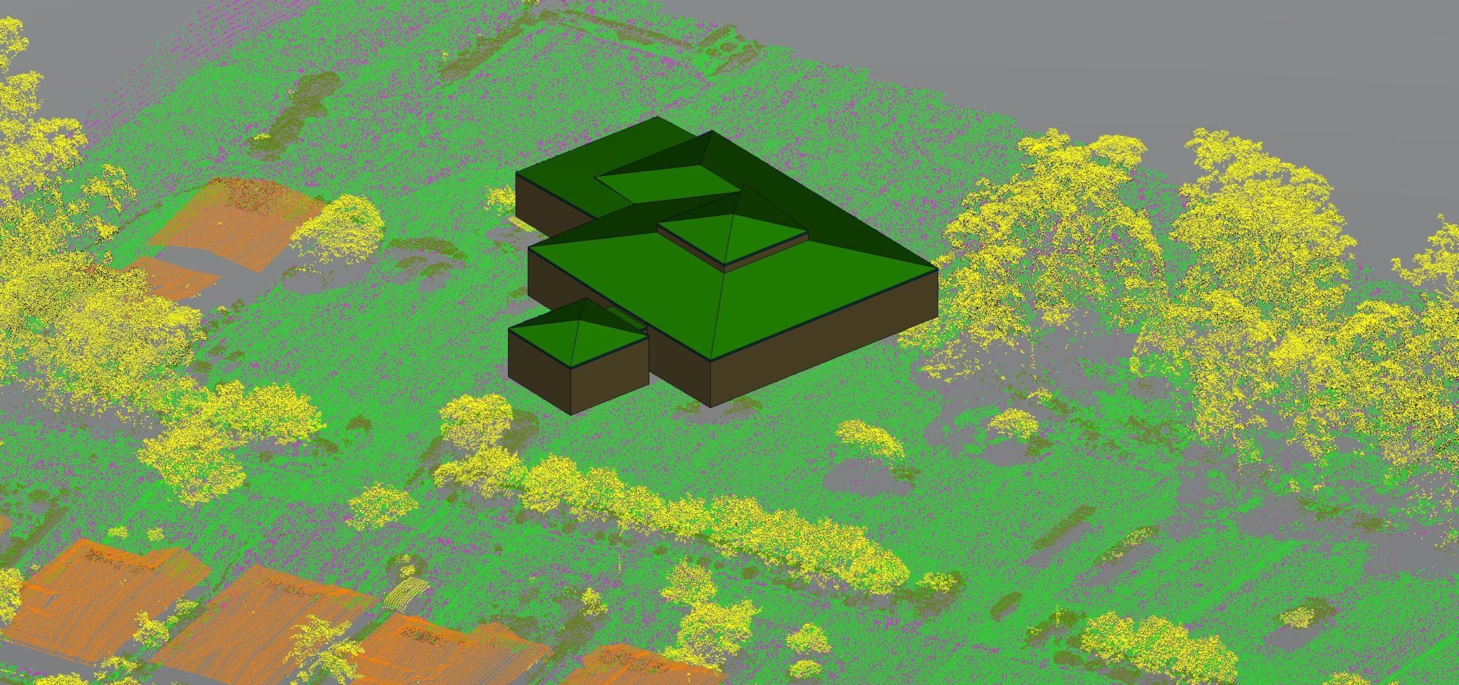
What is LiDAR? The idea is to have a unit – we call this the ‘rover’ – that can send out a laser beam which hits a target and bounces back to a sensor. An onboard computer then calculates the distance and position of the target from the rover. As the laser is light, it travels at the speed of light. The computer uses a distance = speed x time equation to accurately determine how far away the object is from the source (rover) – this all happens almost instantly.
Multiple lasers are used, rapidly returning surface information from everything within range. Measure Australia’s equipment has 32 lasers each activating for a nanosecond in sequence. This allows for up to 1.4M individual points to be collected per second with an accuracy of 35mm RMSE. This information is used to build a 3D model of the environment surrounding the rover. Drone-based LiDAR is an exceptional tool to use; however it can be affected by environmental factors.
Environmental Factors Can Affect LiDAR Scanning
Because LiDAR operates through the emission of light pulses, any environmental factor that can affect those light pulses can affect the LiDAR sensor’s ability to gather data accurately. For example, studies have shown that dust can interfere with the accuracy of the readings because small particles can partially block some of the laser light emissions. Humidity is also a factor because humid air has a different density than dry air, which can affect the calibration of the sensor. Heat, especially extreme temperatures can also affect the operation of the drone itself as well as the sensor so that readings may not be as accurate. Of course, rain is a factor as well, however, Measure Australia would never conduct a drone-based LiDAR survey in a rain event.
The Importance of Avoiding Environmental Factors
In order for drone-based LiDAR surveying to be accurate, it is important to take into account environmental factors that can affect the accuracy of the readings. The scheduling of drone missions on days with low humidity, clear skies, and the absence of dust is very important to ensure accuracy. For times of the year when temperatures are more extreme, drone missions should be scheduled when temperatures are most favourable. Accuracy is paramount when it comes to using drone-based LiDAR, so Measure Australia must pay close attention to upcoming weather events when leading up to a flight. Our operations team and pilots regularly monitor the weather to ensure the environmental conditions are adequate for flying and therefore, safety is assured to all those involved and the quality of data is not affected.
If you would like to learn more about Measure Australia’s drone-based LiDAR, then please submit an enquiry and one of our friendly Business Development staff will contact you shortly.